For many farmers, particularly on heavier soils, black-grass is an increasing problem and the widespread use of metaldehyde slug pellets and residual herbicides, particularly in oilseed rape, can lead to water contamination in many drinking water catchment areas. A water company for example, may need to know precisely where Oil Seed Rape is being grown in order to understand where there might be a problem and in order to engage with farmers and incentivise them to change some of their farming practices.
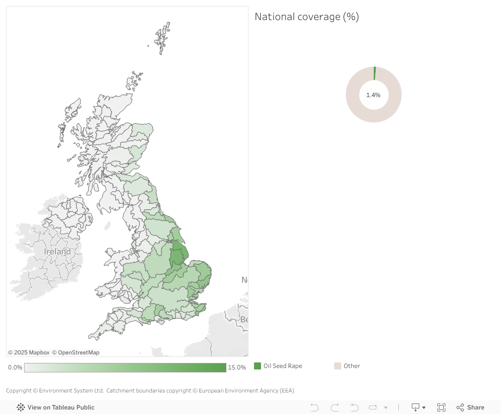
To illustrate the possible extent of the problem we set out to produce the map below which shows the percentage coverage of Oil Seed Rape by water catchment. Underlying this map is a detailed field-by-field map of all the OSR growing in Great Britain. The field-by-field map is derived from Sentinel 1 & 2 satellite data. The image above shows an optical satellite image of fields on the left with OSR identified clearly in the image on the right.
If you are interested in licencing the catchment summary or field scale OSR map for use in your business intelligence, modelling or GIS system please email: [email protected] or call 01970 626688