
Welcome
In this issue of Sphere we have news of a major project for Welsh Government that will help improve land use decision making under a number of different climate change scenarios. We look at greenspace accessibility in the West of England and landscape monitoring in Dorset. News too of new ways to access our Data Services products directly from your GIS. The festive season is upon us so we would like to take this opportunity to send all our readers our very best wishes for a peaceful Christmas and a prosperous 2019.
Contents
Project News
Capability, Suitability and Climate Programme for Wales
From Imagery to Data
Greenspace Accessibility
Landscape Monitoring in Dorset
Company News
WMS and QGIS plugin for Environment Systems Data Services
Team Building Day
Adam Murphy
Project News
Capability, Suitability and Climate Programme for Wales
This three year project which is led by Welsh Government seeks to develop and improve the agricultural land classification model for the whole of Wales. It will assess the suitability of land for over one hundred different crops under 18 projected climate change scenarios. The project is being carried out by a consortium of Environment Systems, Cranfield University, and ADAS.
Initially Environment Systems will be focused on improving the accuracy of the underlying soil data. This will be achieved by modelling the regional distribution of certain soil series types which are known to be under – or over-graded in the Predictive ALC (Agricultural Land Classification) model. We will be analysing features such as pond density, rock outcrops and topographic setting to establish relationships with depth to impermeable clay, and total soil depth, and combining this with image analysis of vegetation characteristics, which will be tested with targeted soil sampling.
In a previous project for Welsh Government, Environment Systems assessed the suitability of areas for the planting of new potatoes. In this suitability modelling pilot, we modelled wind exposure, salt spray and frost pocket locations, and combined this information with a range of other biophysical information to demonstrate variations in land suitability for growing new potatoes. The current project will access additional Met Office data to produce more detailed wind exposure, salt spray and frost models, and apply these to the suitability modelling of over 100 crops.

By identifying the areas that provide suitable growing conditions for different crop varieties and highlighting crop suitability under future climate scenarios, the Welsh Government, farmers, public and private sector organisations will be able to make more informed decisions on the use of land. This will help farmers to think about the future and adapt to changing circumstances. It will give Government a greater understanding of the constraints and opportunities of our natural environment and help develop informed policy.
Three engagement events are being run in early 2019 to inform interested stakeholders about the project, one for the general public, one for Defra and associates and one for Natural Resources Wales and associates.
This project has received funding through the Welsh Government Rural Communities – Rural Development Programme 2014-2020, which is funded by the European Agricultural Fund for Rural Development and the Welsh Government.
From Imagery to Data
The insights that satellite data can deliver for agriculture are hugely valuable but making those insights accessible is not always straightforward for the people who might really benefit from them. We have recently demonstrated, as part of a national trial, the capability to deliver data insights in a simple data dashboard.

In this example NDVI satellite imagery was supplied by Environment Systems Data Services. This 10m resolution product was used for each field for the 2017/18 season on a farm that produces winter wheat, canary seed, spring beans and and oil seed rape. This demonstrates both wide area coverage and the availability of weekly data from Environment Systems Data Services. 2017/18 season field statistics derived from both NDVI and radar satellite data were presented in a simplified business intelligence dashboard to demonstrate the capabilities for tracking and comparing field performance.
Near real time satellite data availability and analyses are now enabling growers to identify patterns and trends helping with both future planning of crop rotations and risk management.
Greenspace Accessibility
The West of England Nature Partnership (WENP) is working to enhance cultural ecosystem services in the West of England by ensuring that the value of accessible greenspace is implicit in decision making across spatial planning, public health and economic development. We were recently asked by WENP to establish current greenspace accessibility for the region. There is growing evidence of the physical and mental health benefits of green spaces. Research shows that access to greenspace is associated with better health outcomes, and that income-related inequality in health is less pronounced where people have access to greenspace.

On this project we took a range of existing greenspace datasets, some of which had known access points. Where the access points were not mapped, we produced modelled access points using the Ordnance Survey Integrated Transport Network (ITN). We also used the ITN to produce separate ‘walkable’ road networks for urban and rural areas, based on the road category, how busy the road is likely to be, and whether the road is likely to have a pavement. For example a busy B-road in an urban area might only be walkable if it had a pavement whereas a B-road in a rural area might be walkable simply because it carries much less traffic. We then ran a routing analysis to identify all of the areas falling within a 300m travel distance of a greenspace, producing catchment areas applicable to each. The result is spatial data that will enable WENP to carry out further analysis on greenspace accessibility and identify areas that currently have no, or poor access.
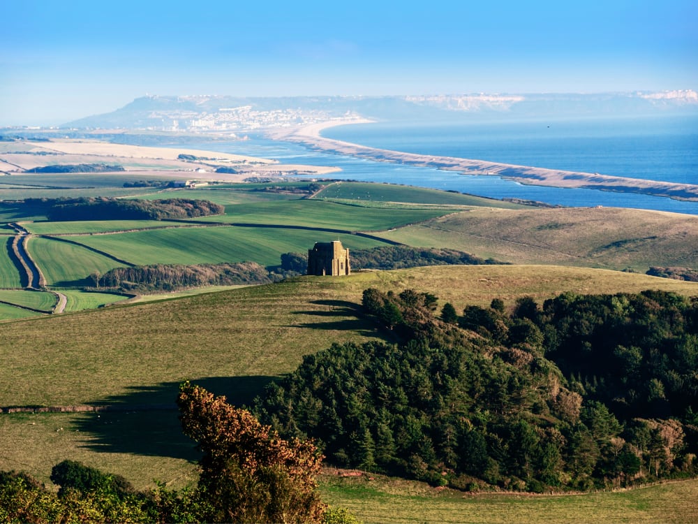
Landscape Monitoring in Dorset
Monitoring change is important for many reasons, and for those working in planning, development and environmental management it can be crucial in ensuring that the characteristics of an area are maintained or enhanced. Earlier this year Environment Systems was commissioned to undertake up-to-date analyses of the natural, built and historic environments, and to identify the different types of change that have taken place since 2007. The study focused on the Dorset area, specifically in the Dorset AONB and an extended area including parts of Hampshire, Wiltshire and Somerset.
Initially our work focused on the natural environment. Detailed Phase 1 habitat data existed for part of the study area, but there were large gaps in coverage which we had to fill to create a seamless map. We achieved this using remote sensing image analysis of Sentinel-1/2 data and image segmentation using a classification rule-base to identify the basic land cover types. These includednarable, improved grassland, semi-improved grassland, heath, scrub, urban, water, wetland and woodland. In addition, we created habitat connectivity layers for the four key networks: heathland, grassland, woodland and wetland, via landscape permeability analysis.
The built environment presented a different set of challenges because the project required us to not only provide spatial data for the total urban extent in 2007 and 2017 with a range of comparisons but also for a number of features of interest including quarries, pylons, wind turbines, solar farms, caravan and camping sites, and car parks.
Additionally, we provided statistics and spatial data summarising areas that make up the historic environment. These included scheduled monuments, listed buildings, conservation areas, parks and gardens and designed landscapes. This was achieved using data from Historic England and Natural England.
Understanding how habitats have changed over time is important in an AONB especially from a planning perspective. We carried habitat change detection analysis by comparing the current habitat map against older data, and where no previous habitat data existed, through statistical analysis of satellite image data to identify changes in the reflectance characteristics over time.
Much of the data will be shared via DorsetExplorer, Dorset County Council’s publicly accessible mapping portal.
Company News
WMS and QGIS plugin for Environment Systems Data Services

You can now subscribe to a WMS feed for Environment Systems Data Services making it easier and more convenient to access the data available.
In addition you can now view our open data instantly in QGIS by using our latest plugin (beta release). This plugin brings you all the functionality available through our web interface, including the premium service. Just add this repository to your QGIS plugins, and you’re ready to go – https://data.envsys.co.uk/static/qgis/plugins.xml
If you need some ideas on how you can use our free open data, visit our Demonstrator and to find out more about Environment Systems Data Services, visit – https://data.envsys.co.uk/
Team Building Day
 Once a year we down tools and staff assemble to take part in team building activities. This provides us with a chance to get to know each other better, work frantically and competitively in teams on some practical task that is both fun and challenging. Two years ago we set about litter picking on Aberystwyth beach, last year we built bug hotels. In October we travelled to some remote Forestry Commission woodland near Aberystwyth, and the site of a Scout activity centre. Having split into 4 teams we tackled, fire lighting, archery, rifle shooting, catapult building and tent erection. Despite rather dank weather a great day was had by all finished off by drinks and dinner back in Aberystwyth.
Adam Murphy
 Adam joined us in the summer as an ornithologist working with our Ecology team. He has a BSc in Biology from the University of Exeter and an MSc in Ecology from Lund University, Sweden.
Before joining us he worked in Turkey for Doğa Derneği (Birdlife Turkey) as a Biodiversity Assessment Officer. Previous positions include Researcher in Madagascar (Society for Environmental Exploration), Information Officer (RSPB & Yorkshire Dales National Park).