The Caldicot and Wentlooge Levels collectively known as the Gwent Levels comprises two areas of low lying wetland and mudflats adjoining the north bank of the Severn Estuary, either side of the River Usk estuary near Newport in south east Wales. The Gwent Levels is one of the largest areas of reclaimed grassland in the UK; its unique landscape has evolved over hundreds of years and is recognised for its archaeological remains and the distinct field patterns first reclaimed from the sea by the Romans. The area is important for biodiversity, recreation, ecosystem services such as flood alleviation, carbon storage and food production. It is also culturally important to the communities that live there. Currently a Welsh Government funded sustainable management scheme (SMS) is in place, a project managed by the RSPB entitled ‘Sustaining The Gwent Levels.’ The project forms part of the larger Living Levels National Heritage Lottery Fund programme on the Gwent Levels.

Both the SMS Sustaining the Levels project and the Living Levels programme focus on working with farmers and partners to re- establish the management of the inter-field drainage ditches, known locally as ‘reens’, as part of a sustainable farming system, which also protects water quality, soil health, and helps to maintain the integrity of designated sites (SSSIs). The SMS project will also provide demonstration sites to inform the wider farming community, as well as policy and decision makers, of the benefits and challenges of implementing a sustainable land management system. At the same time, it will work to ensure local communities have improved knowledge of the various benefits that sustainable farming can provide.
Environment Systems, working with the University of Gloucester and the Countryside and Community Research Institute (CCRI), has been commissioned to design and implement a programme of monitoring for the SMS. This involves creating a baseline for established habitats and connectivity through ground surveys and imagery from Sentinel satellites. The data will also be used to model any habitat and ecosystem changes over time using our own SENCE tools and methodology.
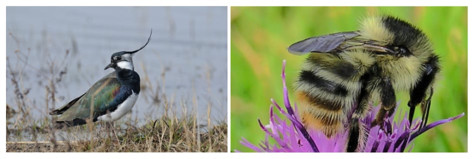
We will also ensure that the SMS for the Gwent Levels aligns with national monitoring programmes to provide key data and evidence underpinning Welsh environmental legislation and SoNaRR, which assesses the extent to which natural resources in Wales are being sustainably managed. Robust evidence from the monitoring programme will help to illustrate the benefits of ecosystem services and sustainable habitat management. It will also help identify opportunities for the creation of new habitats, nature conservation and mitigation against flooding and risks to pollination. Particular attention will be paid to the monitoring of protected priority species that thrive in the Gwent Levels specifically Lapwing and the Shrill Carder Bee.
