Understanding dark skies is important for nocturnal species conservation. For example, certain species of bat, many of which are rare and have declining populations. By having strategic knowledge about dark skies at a regional level, it becomes possible to plan mitigation and development activities to enhance the area for these species. Dark night skies are also an important landscape feature protecting the nocturnal environment, not only for nature, but also for education, cultural heritage, and public enjoyment.
We have recently undertaken a project for Pembrokeshire County Council and Natural Resources Wales, looking at how we can obtain a strategic landscape view of dark skies and bat populations. The project used newly accessible satellite data and available street lamp data to demonstrate dark sky areas throughout Pembrokeshire. The aim was to raise awareness of light pollution and its impact on biodiversity and provide a tool to evidence policy, inform development and land use. Using these data would also enable mitigation in many cases simply by reducing light pollution in the most sensitive areas.
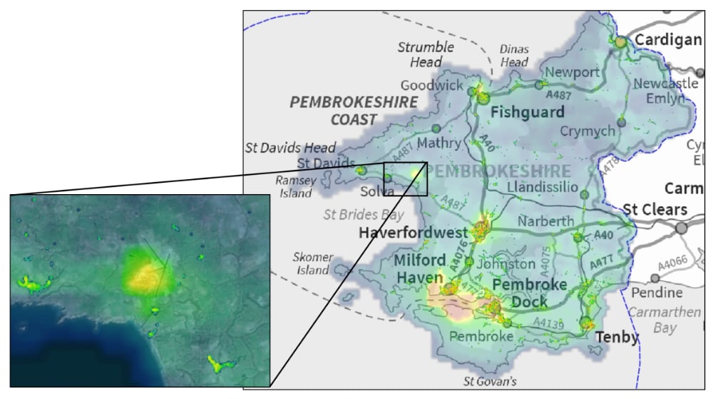
Calibration of the satellite data was necessary to split marine and terrestrial environments due to exceptionally busy shipping lanes around Milford Haven, producing light out at sea. Street lamp data was available from Pembrokeshire County Council. By taking the location of the street lamps and the types of lamp it was possible to match the existing pollution level to the radiance values in the satellite data creating a mapping layer of dark skies and light pollution.
The next stage of the project focused on generating a biodiversity sensitivity layer. For this project, local bat species data, with details on hibernating, maternity, plus day and night roosting sites, was used. Whilst the impacts of artificial light pollution on plants and wildlife are generally understood, it is now being recognised as being more significant to land use planning and development design. Combining the light and bat species data together delivers information that will assist local authorities in providing advice for better land management and development in relation to the effects of light pollution on biodiversity.